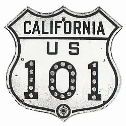
Home > Route Selection > US 101 > History > California
Route History for US 101 in California

- (under construction)
- In 1936
- US 101 followed H Street and 2nd Street through Crescent City. (I assume 2nd Street used to exist between I Street and J Street. Today there is a gap here.)
- In Klamath, the route followed what is now Old Highway 101.
- Leaving Klamath to the south, US 101 followed Alder Camp Road (the road used to cross the Klamath River), Coastal Drive, and the Newton B. Drury Scenic Parkway.
- Leaving Orick to the south, US 101 followed what is now Old State Highway to the east of Freshwater Lagoon.
- From the 1960 map it appeared US 101 followed Patricks Point Drive and possibly Scenic Drive between Patricks Point and Westhaven (see below), but this is much less obvious from the more detailed 1936 map.
- Between Clam Beach (current exit 725) and McKinleyville (current exit 718) US 101 followed Little River Drive and Central Avenue.
- US 101 most likely followed G Street through Arcata.
- In Eureka, 4th Street was a two-way street, carrying both directions of US 101 traffic.
- South of Eureka, US 101 most likely followed South Broadway Street, and then Fields Landing Drive in Fields Landing.
- Near Loleta, US 101 may have followed Eel River Drive from Beatrice through Loleta, or may have arrived from the north/east via Loleta Drive, then followed Main Street to Eel River Drive to leave town to the south.
- US 101 followed Fernbridge Drive through Fernbridge.
- In Fortuna, US 101 followed Main Street, then exited to the south via North Fortuna Boulevard and South Fortuna Boulevard, then Kenmar Road and Eel River Drive.
- In Alton, US 101 followed what is now called Old State Highway.
- In Rio Dell, US 101 followed Wildwood Avenue (CA-283). This becomes Main Street as the former routing passes through Scotia and continues south. Today, Main Street eventually becomes a dead end across the river from current exit 676.
- Between Pepperwood (current exit 674) and Phillipsville (current exit 645) US 101 followed what is now CA-254, the Avenue of the Giants.
- Beginning in Redway, US 101 followed Redwood Drive, continuing south through Garberville.
- From Benbow (current exit 636) US 101 followed Benbow Drive south to where it rejoins with current US 101. A short section of the route that had followed what is now Old Hwy 101 had been rerouted to Benbow Drive.
- Between Cooks Valley and Reynolds (current exit 625) US 101 followed what is now CA-271. South of Reynolds, US 101 followed the road called CA-271 to its dead end. Between Leggett and Cummings US 101 again followed what is now CA-271.
- North of Laytonville, US 101 most likely followed Woodruff Road and Mendocino County Route 307.
- South of Longvale US 101 probably used to follow Underpass Road.
- Between Calpella (current exit 557) and Ukiah (at CA-253), US 101 followed North State Street and South State Street.
- In 1960
- US 101 north of Crescent City had not yet been widened to 4 lanes. One of the site's visitors, Jered, reports that at one time US 101 followed S Fred D Haight Drive, Lake Earl Drive, and Northcrest Drive between Smiths River and Crescent City.
- Between Klamath (current exit 765) and Orick (current exit 753) US 101 followed the Newton B. Drury Scenic Parkway. It is not clear if it still followed Alder Camp Road and Coastal Drive north of the Newton B. Drury Scenic Parkway or if US 101 had been moved to its current alignment.
- South of Orick it appears US 101 had been moved to its current alignment.
- Between Patricks Point (current exit 734) and Trinidad (current exit 728) US 101 followed Patricks Point Drive. From here US 101 may have followed Scenic Drive to Westhaven and the entrance ramp near mile 726.
- Between Clam Beach (current exit 725) and McKinleyville (current exit 718) US 101 followed Little River Drive and Central Avenue.
- US 101 had been upgraded to a 4-lane divided highway through Arcata.
- The route had also been upgraded to a 4-lane divided highway through Fernbridge and Rio Dell.
- Between Pepperwood (current exit 674) and Phillipsville (current exit 645) US 101 still followed what is now CA-254, the Avenue of the Giants.
- In Garberville, US 101 followed Redwood Drive.
- Between Cooks Valley and Reynolds (current exit 625) US 101 still followed what is now CA-271. South of Reynolds, US 101 followed the road called CA-271 to its dead end. Between Leggett and Cummings US 101 again followed what is now CA-271.
- Between Calpella (current exit 557) and Ukiah (at CA-253), US 101 still followed North State Street and South State Street.
- Between Preston (current exit 525) and Healdsburg, US 101 followed Geysers Road to a point across the Russian River from North Cloverdale Boulevard. From there it followed North Cloverdale Boulevard, South Cloverdale Boulevard, Asti Road, Geyserville Avenue, and Healdsburg Avenue.
External websites of interest:
Welcome Page | Route Selection | US 101 Main Page | History of US 101 | US 101 History in Oregon | Site Map
If you have any questions / comments / corrections for this website or find a broken link, please e-mail me.
Copyright 2006-2013 by Robert Mortell

